California Desert Regions
California’s 25,000 square miles of desert runs from Deep Springs south to the Mexican border, and west from the Arizona border to Palm Springs and the town of Mojave. Considered California’s “Outback,” the desert regions offer warm air, unique outdoor adventures, and a chance at an escaping solitude. The area is known for its spectacular sunsets and at night, far from city lights, the stars fill the heavens in an amazing celestial show.
The California desert is one of the top outdoor recreation areas in the continental United States. Every year recreationists to the area are estimated to spend more than $230 million visiting the region and its national parks have nearly 3 million visitors annually. With the abundance of trails from which to experience painted mountains to Native American sites, hidden springs to desert tortoise, and world-famous wildflowers to herds of majestic bighorn sheep, it is no wonder travelers have long been drawn to the stark beauty of California’s desert.
Popular destinations include, Route 66, which Smithsonian Magazine named as one of the ‘10 Must-See Endangered Cultural Treasures,’ wildlife viewing of the hundreds of birds at the Salton Sea, the Ocotillo Wells State Vehicular Recreation Area with more than 80,000 acres of magnificent desert area open for off-highway exploration and recreation, and the magnificent Palm Springs.
In contrast to its harsh rugged side, the desert also offers many oasis’s of luxury. Relaxation is key at the innovative spas in Desert Hot Spring, famous throughout the world for its natural hot mineral waters. El Paseo Drive in downtown Palm Desert is often compared to Beverly Hills’ Rodeo Drive with an upscale shopping district featuring 150 boutiques, art galleries, and restaurants. Outstanding golf venues abound in Palm Springs where the pros and stars swing their irons on famous courses.
HISTORY
Since ancient times, many indigenous tribes have lived in the desert where life could sustain them, including the Mohave tribe for which much of the desert was named. Early European explorers saw the desert as a barrier to the more habitable West Coast but the trails they blazed can still be traced. With the discovery of gold came the miners. Establishing towns that died as the minerals played out, leaving their skeletons to become ghost towns. With the turn of the 20th century, areas with dependable water supplies gave rise to cities. Military bases took over after WWII, when General Patton rolled tanks and trained troops in the eastern Mojave. In 1994 millions of acres of desert became protected within the Death Valley and Joshua Tree National Parks and the Mojave National Preserve.
GEOGRAPHY
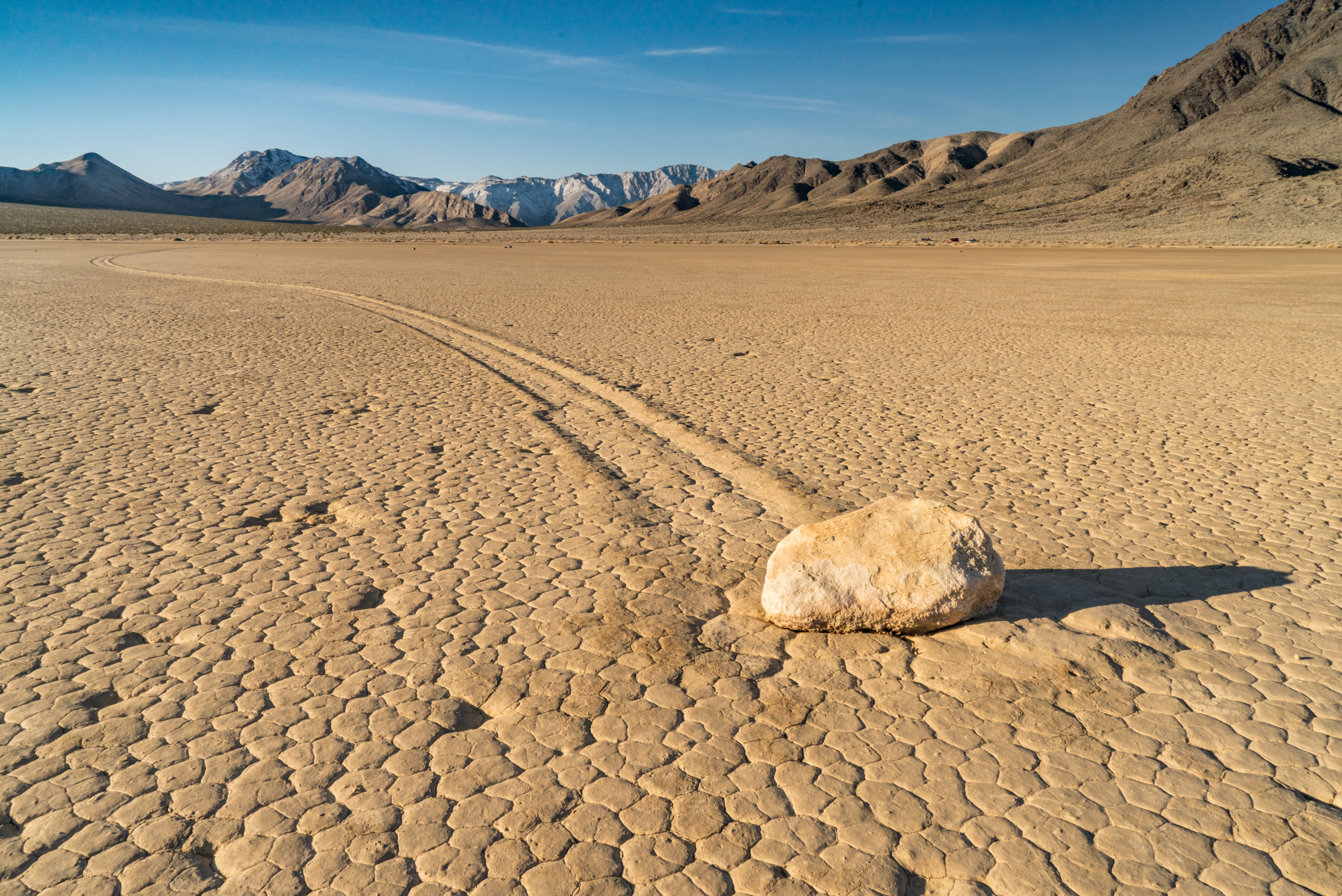
The three main deserts in California; the Mojave, the Colorado, and the Great Basin have a basin and range topography. Characterized by a series of separate and parallel mountain ranges with broad valleys, the deserts have a unique beauty in their plateaus, canyons, gorges, and vast expanses of sand interrupted only by the seeming mirages of mountain peaks. Bordered by mountain ranges and the two largest faults in California, the Mojave Desert, the high desert, has elevations that range from three to six thousand feet. Death Valley National Park, inside the Mojave, includes both 11,049-foot Telescope Peak and the lowest point in the United States, 282 feet below sea level at Badwater. The Great Basin, with its vast, rugged landscape, is an arid land broken by hundreds of mountain ranges (with peaks rising to as high as 14,000 feet), breathtaking canyons and cliffs, pine forests and aspen groves, lush-banked streams, even waterfalls and lakes. South of the Mojave is the Colorado Desert’s 7 million acres. Stretching down to the Mexican border, the Colorado Desert’s elevations run from 230 to 1,000 feet (−70.1 to 300 m) above sea level, with the lowest point of the desert floor at 275 feet (84 m) below sea level at the Salton Sea.
WEATHER/CLIMATE
There is a lot more to desert weather than just heat and sunshine. Each desert has its own distinct climate with the shared characteristic of the dramatic daily temperature extremes; there is often a difference of 50° F or more between day and night. The climate in California desert areas is typically clear with low humidity. Temperatures are most comfortable in the spring and fall, with an average high/low of 85 and 50 F respectively. Winter brings cooler days, around 60 F, and freezing nights. Summers are hot, over 110 F during the day and not cooling much below 90 F until the early hours of the morning. Winds may also be quite strong in the desert and may gust well over 40 mph during any part of the year. The higher elevation deserts including the Mojave Desert, Owens Valley, and the Modoc Plateau, have hot summers and cold winters. Rain falls mostly in the winter but during the summer months the region is affected by the Mexican Monsoon which drives moisture from the tropical Pacific, into the deserts, setting off brief, but often torrential thunderstorms, particularly over mountainous terrain. Death Valley is the Mojave’s hot spot, with summer days often a blistering 120° F or more. (The record is a toasty 134° F!). It is also the dry spot, averaging less than 2 inches of rain a year in the low valley. The low deserts, Colorado Desert including the Imperial and Coachella valleys and the lower Colorado River, have hot summers and nearly frostless mild winters. The Great Basin Desert, sitting at higher elevations than the others, experiences a long, cold winter and a significant proportion of its precipitation falls as snow.